

|
|
|
My Dad and I had wanted to take a trip to the Grand Canyon for many years. Our idea of a fun vacation was to take just a backpack of necessities and a gun and walk across the canyon. As it turns out, you aren't allowed to hunt in the canyon. So then we decided to drive across the US looking at all the sorted monuments. We started by listing all the things we wanted to see and then plotted them on a wall size map of the US. A pattern quickly emerged, there wasn't anything in the mid west that was high on our list to see. Everything had been on the west side of the US. We decided to just fly into Las Vegas, rent a car there and drive a big loop to view the assorted destinations. This is the record of the trip out West.
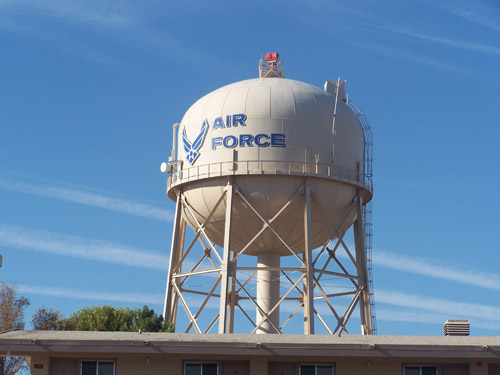
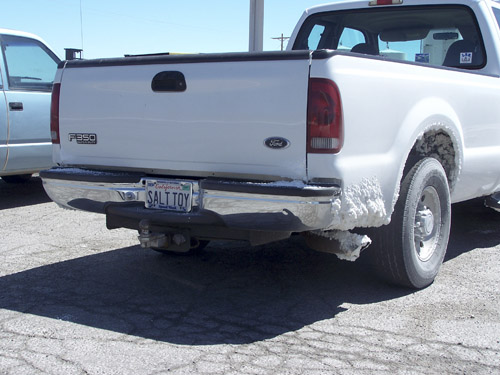
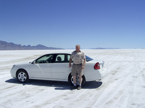
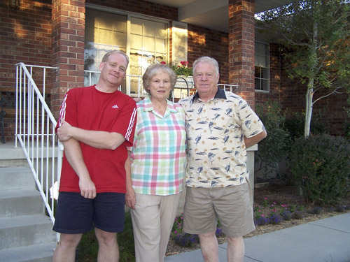
June 28, 2007 Trip has begun. Anne and the kids dropped us off at the airport around 7:30; the flight was at 9:45. The check in and security were pretty fast so we had lots of time to reflect the upcoming trip. While waiting at the gate I asked the lady next to us if her computer was working wireless, which started a long discussion. She really was a complainer. All she wanted to do was gripe about having to live with her mother. The flight wasn’t too long, about four hours. We arrived at 11:30 or so. Once in Vegas I woke up again. I can’t believe the amount of people going to that town so late at night. We had to pick up our rental car. At the car rental place the fellow giving out the cars told us to go ahead and pick a full size car, we were only supposed to get a compact. We ended up with a Chevy Malibu. The trip to Nellis AFB was pretty short and we had no problems finding it. The accommodations were pretty nice. The guy at the desk, supposedly in the Air Force, had the skinniest arms of any guy I’ve ever seen, and he had really small hands.
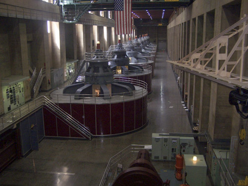
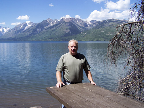
June 29, 2007 We got up about six in the morning, only slept for four hours. We set out to get breakfast but didn’t find anything good, ended up eating at a McDonald’s, yuck. Our first stop was the Hoover Dam. On the way to the dam we saw lots of boats being pulled. Dad said “There must be a lake around here somewhere,” I gently reminded him that we were near a dam and that meant there would be a lake. The Hoover Dam was OK. It was really hot out but at least it was “dry” heat. The wind was blowing quite a bit and you could tell it was responsible for many tourists’ hats being blown off onto the cliffs. There was a new bridge being built which will be pretty impressive once done, it will eliminate have to drive over the Dam. The video on how the dam was build was pretty short and not too informative. I did learn that there were 96 people killed during the construction and of which none are still in the dam. We also learned that the average worker earned $4 a month.
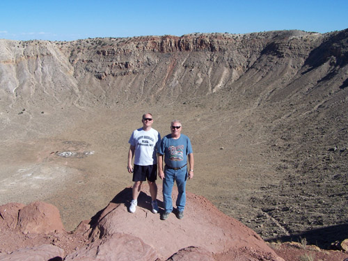
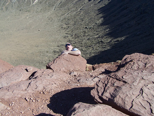
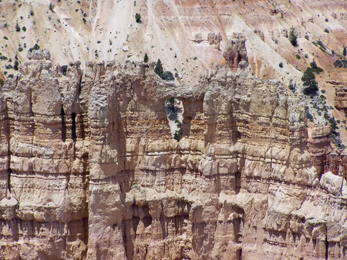
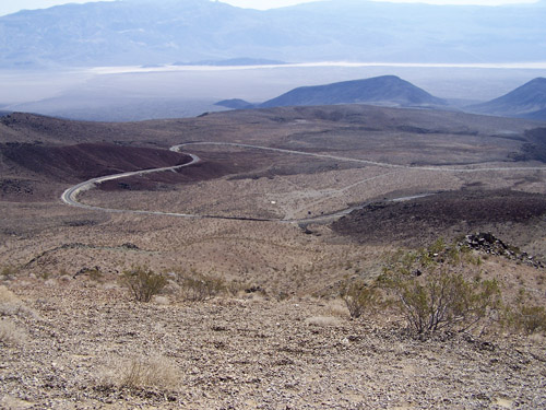
Next destination was the meteor crater. We actually saw the rim of the crater from the main road even though it was still six miles off the road. The property leading to the crater was private and it was being used for cattle. The crater itself is privately owned. We learned that the crater was created by a 150 foot meteorite. There was a sample of the meteorite in the museum; it is made from 96% iron, 3% nickel and 1% trace elements. We took the rim walk tour which was only a mile round trip. The temperature was around 90deg but the wind was gusting pretty hard. Dad really like the crater, I guess the fact that he never heard of it and was surprised by the view really impressed him. There were rocks you could buy at the museum but I managed to grab one on the rim trail while the tour guide wasn’t looking.
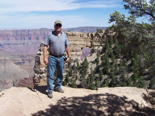
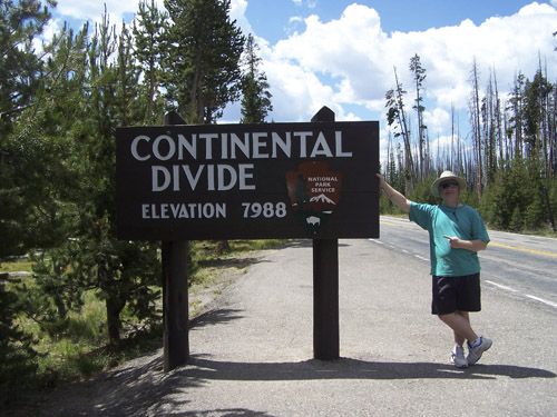
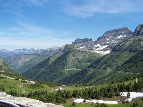
Once done at the crater we headed back to flagstaff to get a hotel room. The first hotel was fully booked because of some baseball competition, we got lucky with the next one, Motel 6. Once in the room we tried the wireless and were able to use the signal from the hotel next door, buwahaha. We made a short trip to one of the local stores for supplies and then headed to the Outback for some grubs. They had Fat Tire beer so I talked Dad into it and it seems he doesn’t like the taste of good beer after all these years for drinking Coors. We hit the sack around 10PM since we were pretty tired. The hotel room was freezing so I got a pretty good night’s sleep. June 30, 2007 We managed to get up at 6AM. We headed to Cracker Barrel which was right down the road. The drive to the North rim of the Canyon was very long but the landscape was pretty diversified. We decided to go to the North Rim of Grand Canyon since the brochure said that only 10% of the visitors go there. It is really surprising how high in elevation the entrance is, 8000 feet. The roads are kept in excellent shape. Dad finally got his lifetime pass to the National parks, only $10. We should get in for free at the rest of the parks.
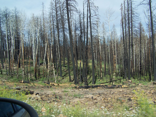
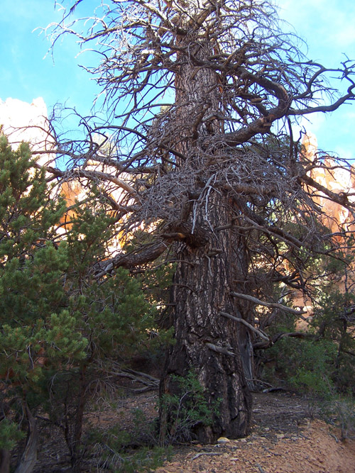
Once in the park we saw major areas of burned trees. There was a fore in 2000 that burned a huge section of the forest. You could see that people were starting to clear out sections of the dead trees. We saw a plaque that explained that the burn off is a part of nature and that it removes ground waist while creating new nourishment in the soil. Here in the East these forest fires always comes across as such a big deal, but out here I see the park rangers and such don’t see the fires as a threat.
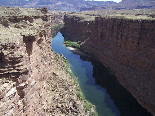
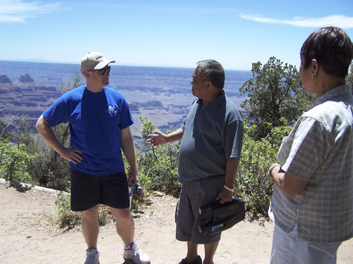
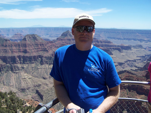
We parked at the very bottom of the North Rim. Within ten minutes of us being there I heard Dad say “I know that guy”. I turned around and saw the Bautistas, Mom, Dad, Loloi, and a sister, friends of my in-laws. We talked to them for about 20 minutes and headed our way. Of course papa Bautista had to give us a Tagalag lessen first as he usually does. Since it was pretty hot out, around 100degF, we thought we would take the ¼ mile trail to the rim. With the heat and the up and down elevation it felt like two miles. I think they messed up on the map. The high altitude probably played a role in us getting winded so quickly.
Once finished with the scenery we drove down to Cape
Since we wanted to be at
The park was beautiful with high rock walls and many colors.
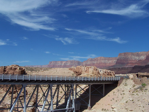
There was also a ten mile tunnel. The
road literally ran next to the walls of the canyon.
If anyone is in the area this park is a must see.
Other than the size,
Back in the hotel we found out that the computer didn’t operate
anymore. This meant we had to get it
fixed or I would have to write my notes out by hand.
We planned on getting it fixed when we get to July 1, 2007
We got up fairly early again. Ate
breakfast at the hotel and left by 7:00AM. Our
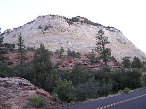
first destination for the day was On our way to Bryce we had to drive through Red Rock. Red Rock is a small section of canyon like rock which is very red (one of the Southwest’s standard colors). Since the mountains were so pretty, we stopped at the first turn out for some pictures.
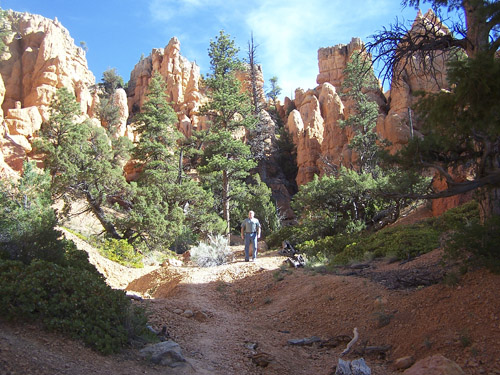
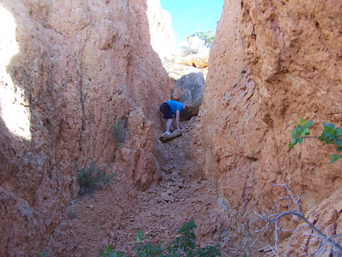
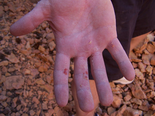
Since the temperature was only 58degF we decided to walk one of the trails which led half way up the mountain. Dad was in his sandals but was comfortable enough walking up the trail. The thin air (and maybe us being out of shape) made progress pretty slow. Then he had an epiphany, “let’s go up that trail”. Well, it wasn’t part of the trail and it did look steep. I was a little leery since I was carrying my camcorder and knew we would end up on all fours at some point in order to make the climb. But, being manly I agreed, maybe not the best choice in the long run. The first chore was climb up a five foot rise with only a couple of boulders and two dead roots to hold on to. Little did I know it was going to get tougher. Once above the rice it very tough to ascend because the rocks were loose, the ones on the floor of the path. I had Dad go ahead so that I didn’t have to worry about the rocks sliding down my way. We took turns ascending. At the last 20 feet Dad chose to go right and I decided the path looked better on the left. He got stuck half way up his path due the loose rock and steepness but I made it to the top. Dad slipped a little and realized that he couldn’t go further so he started back down. As he started down it became obvious that the trip down was going to be much harder. He practically slid down to the first big rock. Then I had the daunting task of descending. On the way down I had to be careful to not use my hand with the camera for balancing. I used a large rock for sure footing and it gave away. As I was slipping I rode the rock like a surf board and grabbed a bigger rock to stop myself. In the process I cut my leg and scraped my forearm, elbow and right hand. I was OK though. My real fear during the slide was what was going to happen to Dad if the rock kept sliding, it was several hundred pounds and there really wasn’t a place for Dad to dive out of the way without tumbling down the path.
It was Dad’s turn again to make the descent. As he started sliding down he used a root to catch and brace himself. In the process he ripped a hole in the seat of his jeans. I haven’t laughed that hard in a long time. Turns out they were brand new pants he bought for the trip. The rest of the way down was uneventful, luckily. By the time we made it back to the car the temperature had gone up to 91degF.
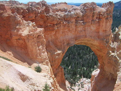
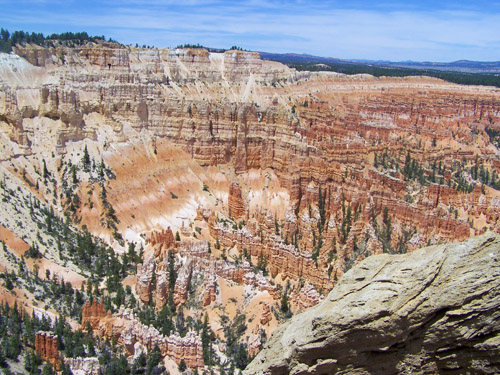
On to
The first stop was the deepest that you could drive to, Rainbow Point. We walked the one mile trail. I could tell that Dad’s leg started to hurt him. The views were spectacular. Many of the pine trees along the path were dead from bugs and “Witches’ Nest” which was a virus. On the way out of the canyon we stopped a few times to get a different perspective of the canyon. As we left the park we ate lunch at the entrance diner.
The next stop is Once in town we quickly found a Motel 6, not the best end of town but it was close to the town center. We rested a little and then decided to go out and get an ice cream. We drove around downtown a little and decided to head back for some sleep. July 2, 2007 First thing on the agenda for the day was to drop off the computer for repair. No one was answering their phone so we went to breakfast instead. After breakfast I finally got a hold of someone who could look at the computer.
We drove out to the
The truck back to Salt Lake City was boring. We reached the motel and rested for an hour before continuing on.
After the short rest we drove to
From the island we drove to a friend of the family, JoAnne.
Had dinner with her and learned a little about the history of
July 3, 2007
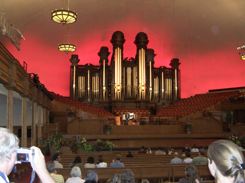
Today we wanted to do a city tour. The
tour bus only had eight tourists on it so the experience was pretty pleasant.
Sights seen were the Tabernacle Quire, a look out point overseeing the
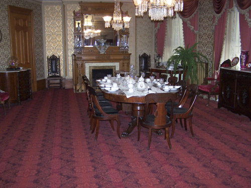
I really enjoyed Brigham Young’s home for its architecture and
furnishings. One annoying aspect was
the tour guide lady kept saying “…provided to us by Jesus
We drove to pick up our computer (which didn’t get fixed) and headed to
Jackson Hole, just below
Entering
July 4, 2007
We drove through
The exit of
The first stop was
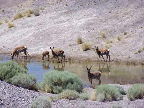
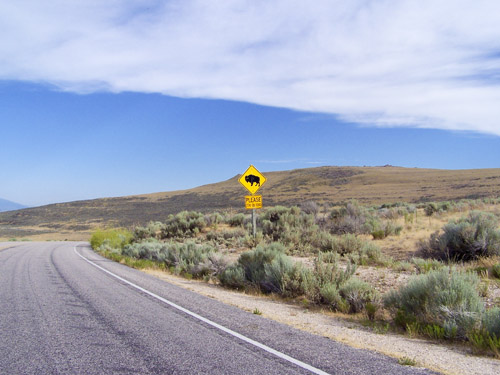
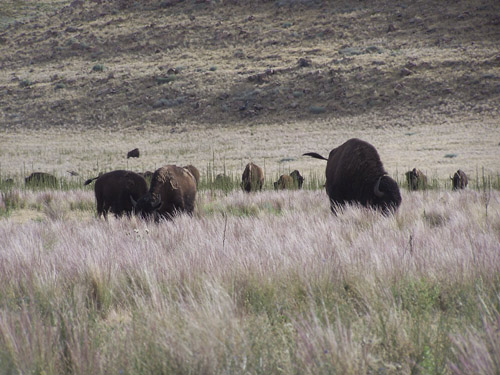
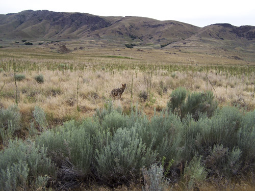
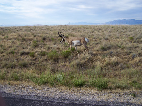
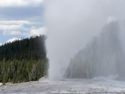
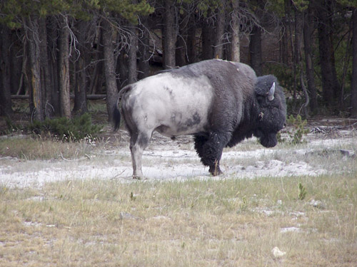
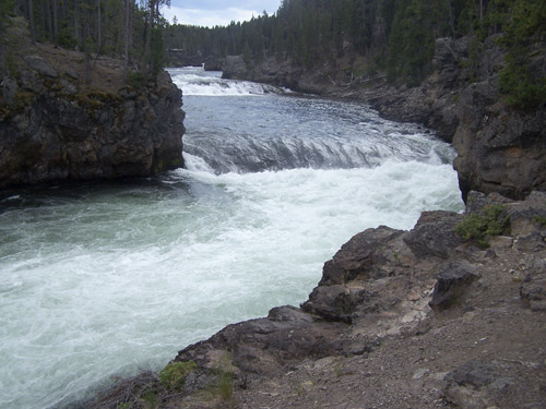
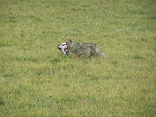
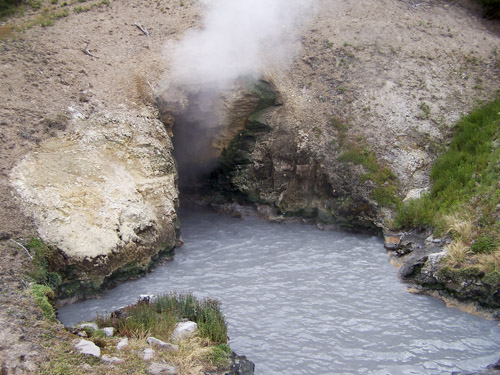
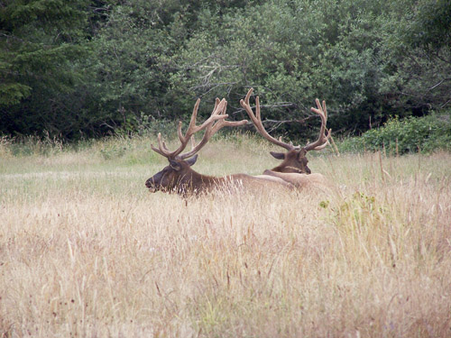
Animals we saw were fox, wolf, elk, prong horn, buffalo, grizzly, mule deer, bald eagle, some other eagle, whooping crane, otters, pelican like birds and a prairie dog. Other noticeable sighs were a couple of water falls, mud volcano and lots of geysers.
We did a figure eight through the park which was just about right for a one day trip. I noticed that at the food stops the servers were mostly foreign students. Spotting the grizzly was a little unusual. There were lots of cars parked on the side of the road so we stopped and asked what the hubbub was all about. Down in the valley fields was a grizzly. It took us about five minutes to find him with our binoculars. Once we found the bear with the binoculars we could then see him with our bare (pun intended) eyes. The bear was so far away you really couldn’t see much detail. I couldn’t even see what the bear was doing; he just looked like he was playing in the field. Buffalos, there were lots of them. After the first the couple of them you got bored with them and also annoyed at the people who stopped in the road to take pictures of them. We did manage to hit the 10,000 ft elevation. We found a dirt road that went up a steep hill and on a whim decided to see where it goes. It took us to a high peak in the park; we could probably see ten miles. I spotted an eagle just sitting in the air in one spot letting the wind hold him up. Also picked up a rock for the kids, should be their highest elevation rock.
We finally made it out of the park at 10:00p.m.
Gardiner July 5, 2007
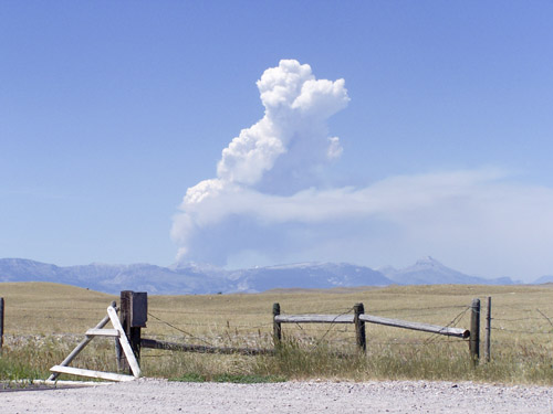
We elected to head toward On the way to Glacier we saw what looked like a volcano eruption minutes after the initial explosion. A huge plume of smoke came from what appeared to be a mountain top. The cloud covered the sky and had a full range of red colors. We stopped along the side of the road where there was a huge valley to get a better look at the cloud of smoke. A trucker pulled in also to get a look and so we asked him what he thought caused the cloud. He told us there was a lightning strike and that caused a flash fire which apparently is very explosive.
Finding a place to stay outside the park was not easy. We finally found a place called Babb. Our Motel didn’t even have AC. After dinner we went back to the Motel and sat on the front porch to watch the cars go by, I think I counted up to six cars.
July 6, 2007
We got up pretty early so we could go into Many Glaciers in On the way back to the car I picked up three rocks from the creek. The creek had the most colorful rocks. The water was so cold that even picking out a few rocks made my fingers numb. The water had to have been at freezing temperature. We went back to the food dive for some breakfast. I ate the worst ever biscuit and gravy.
Then we proceeded to
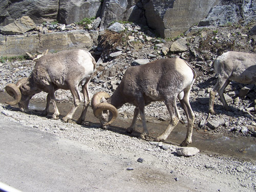
On the way up we saw some Long Horn mountain goats. One dummy got out of his car and walked to about ten feet away from the goats to get a picture.
Nice scenery but I don’t know if I could spend a week in this park. The drive through took us about five hours.
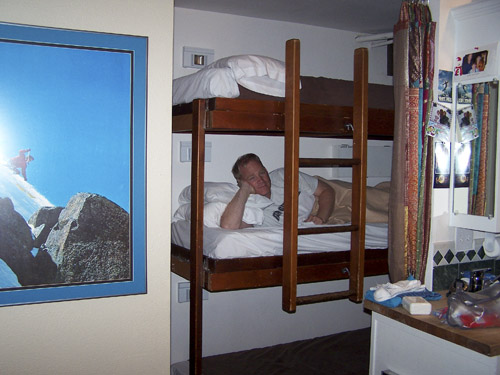
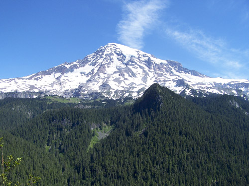
Our next destination was Mount Renier, We drove pretty late and were pushing our luck on motels. The firs one near Renier was full so we had to drive another nine miles to a ski lodge. We were lucky and managed to get an efficiency for a little over $100. The room was so tiny I had to sleep in a bunk bed and Dad slept in a Murphy bed. Even the stove and the microwave were tiny.
July 7, 2007 In the morning we drove to Packwood to eat breakfast. This was a monumental stop; this town had the most unattractive women in it. This was a conversation piece for the next few days. The food was good.
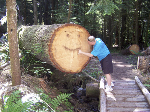
We kept a sharp eye out for smoke on the mountain. No way were we going to get caught up in a firing volcano. The pine trees in this park were absolutely huge. We stopped at one and took some pictures. I walked into the woods and found that a lot had been cut out. On one tree I counted about 250 rings.
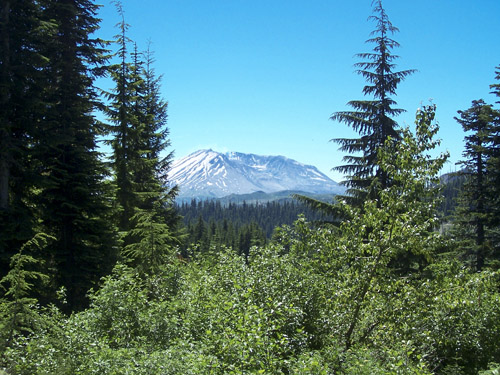
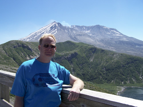
The trip to Mount St. Helens was a fairly short one, about one and a half hours. It is surprising how close these two volcanoes are to each other.
Inside the park area the landscape went through dramatic changes.
At first there were these thick wooded areas with large pine trees then
it changed to sparsely treed mountain sides.
The effect of the
As we made our ascent we came to a point where all the trees were dead and only ground covering grew. It was very eerie looking. You could see many tees were removed in order to keep the carcasses from falling onto the road.
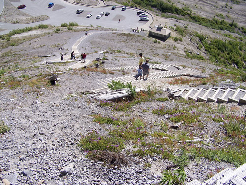
At the top of Windy Ridge you could clearly see As I was standing at the lookout point I turned around and saw these steps going up the mountain we were on. We knew right away that we had to walk up them. I over heard this young lady say that she counted 800 steps. After I made it to the top I think she only counted every third step. We had to take several breaks, between the climb and the wind progress was pretty strenuous. At the top you really couldn’t see much more. The wind blew so hard I was a little worried about my glasses staying on. Going down the steps was much easier.
We went to the South side of Mount St. Helens.
After July 8, 2007
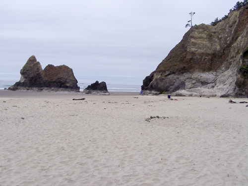
After the continental breakfast we went to After leaving the Fort we headed straight to the coast. At the first sighting of the Pacific we decided it would be fun to go into the water. The beach was sandy but had very few people in the water, which was our first clue. As I got to the water the sand kept getting colder, the water itself must have been just above freezing. After standing in the water less than a minute my feet started to hurt from the cold. Incredible how warm it was outside but the water so cold.
We then drove down the
In
Our next destination was Crater Lake in July 9, 2007
We got up a little late, around 8:00am.
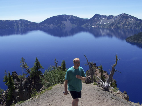
Headed to The crater water was really blue and clear, kind of a “Tidy Bowl” color. I was surprised that there was no commercialism. The road was tricky, there were deep drop offs and no railing to stop you if you ended up going off the road.
We found out that this crater wasn’t even a meteor crater, but a volcano that erupted over 2700 years ago. I even commented how I thought the island in the lake resembled a volcano. At the visitor’s center we watched a 20 minute video which was great. This video is a must see. It showed how after 150 inches of snow the crew cleared the roads, at a whopping pace of ¼ mile a day.
Next we were headed to
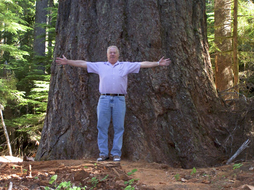
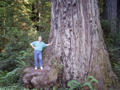
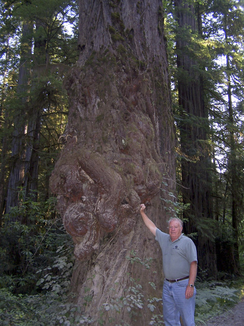
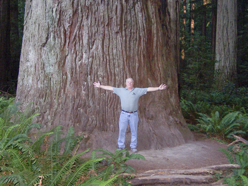
The road went right into These trees get up to 20 feet in diameter and over 2000 years old. We found one tree that at one time crossed the trail so had to be cut. It was about four feet in diameter and by estimating the rings I figured it was about 750 years old, impressive.
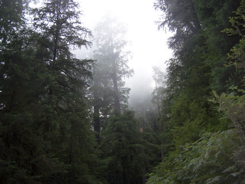
As we started out of the 6.8 mile gravel road we notice the top of the trees were covered in fog. The fog was dropping really fast and the forest began to look eerie, like in a movie. Once out of the forest you couldn’t even see the ocean anymore from all the fog.
The motel we stayed at was a real treat. The lady at the counter had about six teeth and was very proud to tell us she just had a bunch of them pulled. The motel itself looked like the type of place you would go to buy drugs. Had I been with my family we would have looked for another place to stay, but Dad and I could deal with it. July 10, 2007
We got up around 6:00am and headed down the
The scenery was beautiful. What
you see on TV of the coastal road is exactly what we got, mountain side road
with lots of curves. Like in
We hit
July 11, 2007
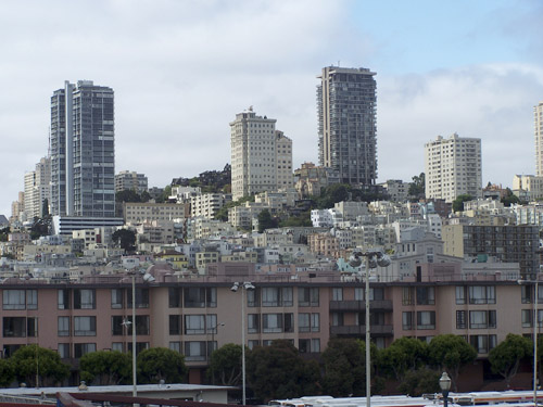
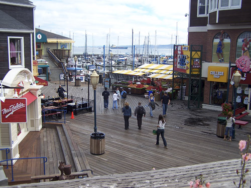
Got up and headed to Fisherman’s Wharf, downtown
Driving through On the way down to the Bay there were miles and miles of strawberry fields. In some fields there were up to 50 people picking the berries. One area even had lettuce; you could smell the lettuce from the car.
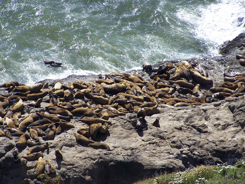
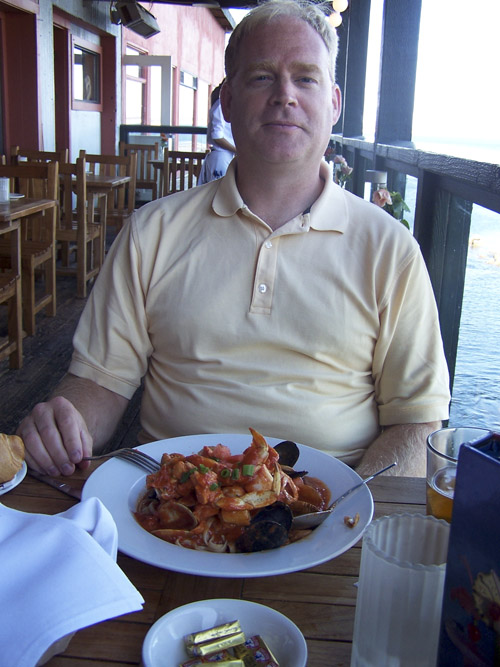
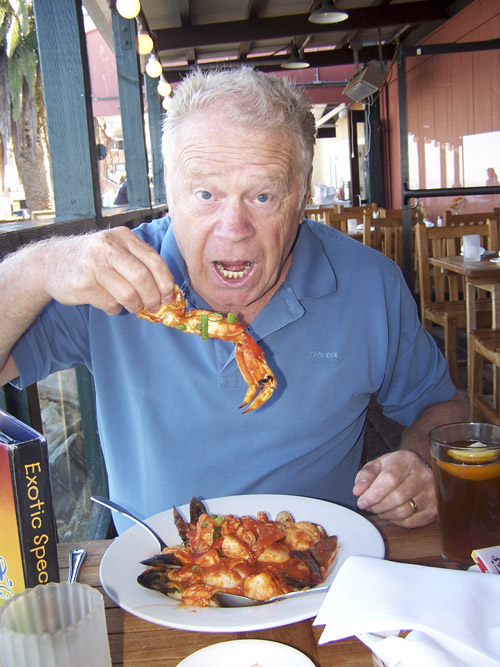
The The highlight was the tank with the tuna and some other large fish. The most interesting fish was the one called sunfish, or “swimming head”. They had two of which the larger one weighed 900lbs. We asked one of the volunteers that worked the aquarium about the fish and he said the fish gets up to 3000lbs. Seems they aren’t edible and none of the other ocean creature hunts them so they are free to grow. After the Aquarium we ate at one of the fancy seafood restaurants. We ate on the balcony and watched the sea lions bathe on the rocks. The both had the combination platter which was delicious.
We headed back to Oakland and arrived just in time to go to bed. July 12, 2007
We were not going to miss our boat to Alcatraz so we got up early and
headed to
The boat docking area was a little confusing, too many people waiting and the lines weren’t marked at all. You pretty much had to ask the last person in line and hope they knew what they were talking about. The boat ride to the island was quick but the cold air was something to contend with.
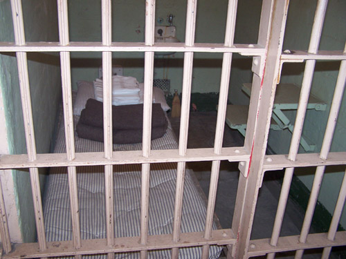
The main cell, as seen on TV, was very interesting. We learned a lot about Al Capone. He was the one who came up with putting expiration dates on milk containers. He also had the first cell phone, 1929, two phones in his cell.
One thing that I didn’t know was that from 1969 to 1971 the Indians
took over the island in protest of the way the The island is a must see. It takes several hours to tour the island and get it all in.
Following the island tour we decided to hit
We finally made it to China
We strolled around town for another 45 minutes. To me the stores sold junk, it reminded me of the catalog China Trading Company.
Once out of town we headed to July 13, 2007
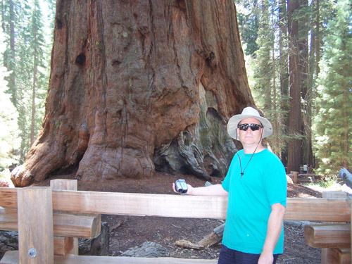
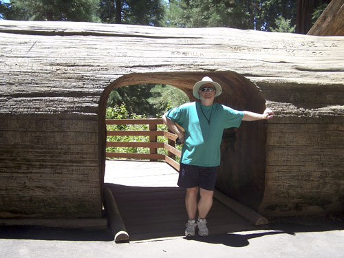
Today our only sight seeing event on the schedule was the The drive through the park was nice. There were some tight curvy roads, especially on the way out. We saw the world’s largest (by volume) tree, General Sherman. Without seeing the tree it is hard to imagine the size. The base is 39 feet in diameter, wider than most people’s house. The trail to General Sherman is a good one to walk. There are a lot of big trees to look at. The trail itself changes 200ft in elevation, not so bad going in but coming out is a different story, just ask Pops. The 6000-7000 foot elevation also didn’t help much either. My Dad had to rest several times. This is where I came up with the nickname for him, Chief Pop-a-Squat. The sequoias are quite a bit different than the Redwoods. Sequoias get up to 40ft in diameter, only 300ft tall and live to about 3200 years. Initially they grow high real fast and then once at max height they just keep adding to the diameter. This makes the older trees look stumpy, as if the tops were cut off. The bark is over 2ft thick and made of fire resistant material.
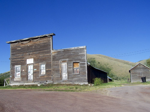
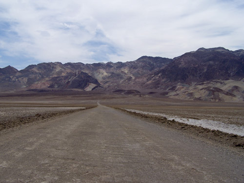
After the park we headed to July 14, 2007 This was to be our hottest day yet, and it turned out that way too. As the day went on we reached a maximum temperature of 122degF. As we started into the valley we passed a filling station where the gas was $4.39 per gallon, more than $1 higher that the normal going price. In the basin we saw a sign that said “Ghost Town”, that was something we had to see. We drove down a gravel road for three miles before we hit the town, Ballarat. There was one guy in the town who oversaw the General Store. You could tell from this guy that he spent a lot of time in this town. He was eager to talk to people. The town had some really old buildings of which only one was complete, the rest were in pieces or just a foundation. It was too hot to walk around and get a closer look at the structures.
We also learned that we were not in Death Valley, but actually the valley
just west of
So back we went. Now we saw
some of the desert items from the other side.
Those little dried up bushes look the same from both sides.
Once we hit the real
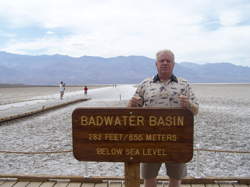
There were a few stops that we made in Death Valley, an old Boron
extracting facility, Devil’s Golf Course and the lowest point in the
If a hot desert is of interest to you, then this is a good place to visit. There are a few things to look at and all the stops have plaques telling a little about the place like its history. I would plan on the better part of the day and make sure you have water and that the AC in the car works. We headed back to Nellis AFB to rest at the hotel a little before evening. Since neither of us felt like going into Vegas we decided to just eat somewhere local. July 15, 2007 This is our last full day of the trip. Since we were in Vegas we figured we should hit the strip. A few passes during the day got us acquainted with the location of the different casinos, then in the evening when all the action is going on we would know where to go. In the evening we drove in and found a parking garage attached to the MGM Grand which is free. We walked through a few casinos and we each had $20 to blow. That didn’t take very long. I really wanted to try my luck at Blackjack but the cheapest table I could find had a $5 minimum per bet, which meant four hands for me, not going to happen. This is really not my bag of wax but the experience was well worth it. Had the temperature not been 111DegF we would have walked around some more. The hotels were really decorated overboard which made the experience pretty interesting. I was surprised at how many people were out at 11:30pm, not just the gamblers but whole families. Had my kids been with us I know they would be hanging over my shoulders out cold. July 16, 2007 It’s the day to go home. I’m ready. I really miss my family and the cooler weather. Not too happy about going back to work though. |